
Found 58 datasets matching filters.
-
The dataset can be used to develop and test algorithms for communication and sensing in the 60GHz band. The dataset consists of synthetically generated indoor mm-wave channels between a MIMO...
Search relevance: 1.00 | Views last month: 8 | Published on: 2025-08-02 -
Analyzed Foundation, Microwave + InfraRed Optimally Interpolated, Near Real Time, Global, Sea Surface Temperature data. The through-cloud capabilities of microwave radiometers provide a valuable...
Search relevance: 1.00 | Views last month: 4 | Published on: 2026-01-27 -
DEPRECATED 2016-04-01 - SEE THE NEW erdVH2018 VERSION. Level-3 Standard Mapped Image (SMI), Global, 4km, Remote Sensing Reflectance at 671 nm, Daily composite data from the Visible and Infrared...
Search relevance: 1.00 | Views last month: 2 | Published on: 2026-01-27 -
THIS DATASET WILL NOT BE UPDATED AFTER 2011-05-23. This dataset was terminated with the demise of the AMSR-E sensor on Aqua. Analyzed Foundation, Microwave + InfraRed Optimally Interpolated,...
Search relevance: 1.00 | Views last month: 2 | Published on: 2026-01-27 -
THIS DATASET WILL NOT BE UPDATED AFTER 2011-05-23. This dataset was terminated with the demise of the AMSR-E sensor on Aqua. Analyzed Foundation, Microwave + InfraRed Optimally Interpolated,...
Search relevance: 1.00 | Views last month: 1 | Published on: 2026-01-27 -
MODIS measures the remote sensing reflectance (Rrs) at 667nm. This can be used to view very high concentrations of phytoplankton in the very surface of the water.
Search relevance: 1.00 | Views last month: 1 | Published on: 2026-01-27 -
This data set contains sea surface temperature (SST) data on a monthly 1 degree grid from the Advanced Microwave Scanning Radiometer (AMSR-E) aboard NASA's Aqua spacecraft. The data were produced...
Search relevance: 1.00 | Views last month: 1 | Published on: 2026-01-27 -
The data sets are generated using the OPTECH ALTM 70 kHz LIDAR system mounted onboard AeroMap's twin-engine Cessna 320 aircraft. Classified data sets such as this one may have varying posting due...
Search relevance: 1.00 | Views last month: 1 | Published on: 2026-03-14 -
Analyzed Foundation, Microwave + InfraRed Optimally Interpolated, Near Real Time, Global, Sea Surface Temperature data. The through-cloud capabilities of microwave radiometers provide a valuable...
Search relevance: 1.00 | Views last month: 1 | Published on: 2026-01-27 -
Moderate Resolution Imaging Spectroradiometer (MODIS) Aqua 3-Day 1km Composite ocean color and sst calculation by SeaDas; Regridded to Mercator lon/lat projection. Processed at the University of...
Search relevance: 1.00 | Views last month: 1 | Published on: 2026-02-26 -
Intermap DEMs populate its data store. The DEM products are generated using Intermap's STAR technology (Interferometric Synthetic Aperture Radar). The system is mounted in an aircraft. The Digital...
Search relevance: 1.00 | Views last month: 1 | Published on: 2025-12-19 -
DEPRECATED 2016-04-01 - SEE THE NEW erdVH2018 VERSION. Level-3 Standard Mapped Image (SMI), Global, 4km, Remote Sensing Reflectance at 671 nm, Monthly composite data from the Visible and Infrared...
Search relevance: 1.00 | Views last month: 1 | Published on: 2026-01-27 -
This vector shapefile is one of two layers that depict the extent of the 2003 digital orthophoto mosaic for the coastal and nearshore areas of Bering Land Bridge National Preserve (BELA), Cape...
Search relevance: 1.00 | Views last month: 1 | Published on: 2026-03-04 -
This vector shapefile is one of two index map layers for a 2003 digital orthophoto mosaic for the coastal and nearshore areas of Bering Land Bridge National Preserve (BELA), Cape Krusenstern...
Search relevance: 1.00 | Views last month: 0 | Published on: 2026-03-04 -
Remote Sensing Reflectance at 667 nm, Aqua MODIS, NPP, East US, 2002-2012 (3 Day Composite), Lon0360
MODIS measures the remote sensing reflectance (Rrs) at 667nm. This can be used to view very high concentrations of phytoplankton in the very surface of the water.
Search relevance: 1.00 | Views last month: 0 | Published on: 2026-01-27 -
MODIS measures the remote sensing reflectance (Rrs) at 667nm. This can be used to view very high concentrations of phytoplankton in the very surface of the water.
Search relevance: 1.00 | Views last month: 0 | Published on: 2026-01-27 -
DEPRECATED 2016-04-01 - SEE THE NEW erdVH2018 VERSION. Level-3 Standard Mapped Image (SMI), Global, 4km, Remote Sensing Reflectance at 671 nm, 8-Day composite data from the Visible and Infrared...
Search relevance: 1.00 | Views last month: 0 | Published on: 2026-01-27 -
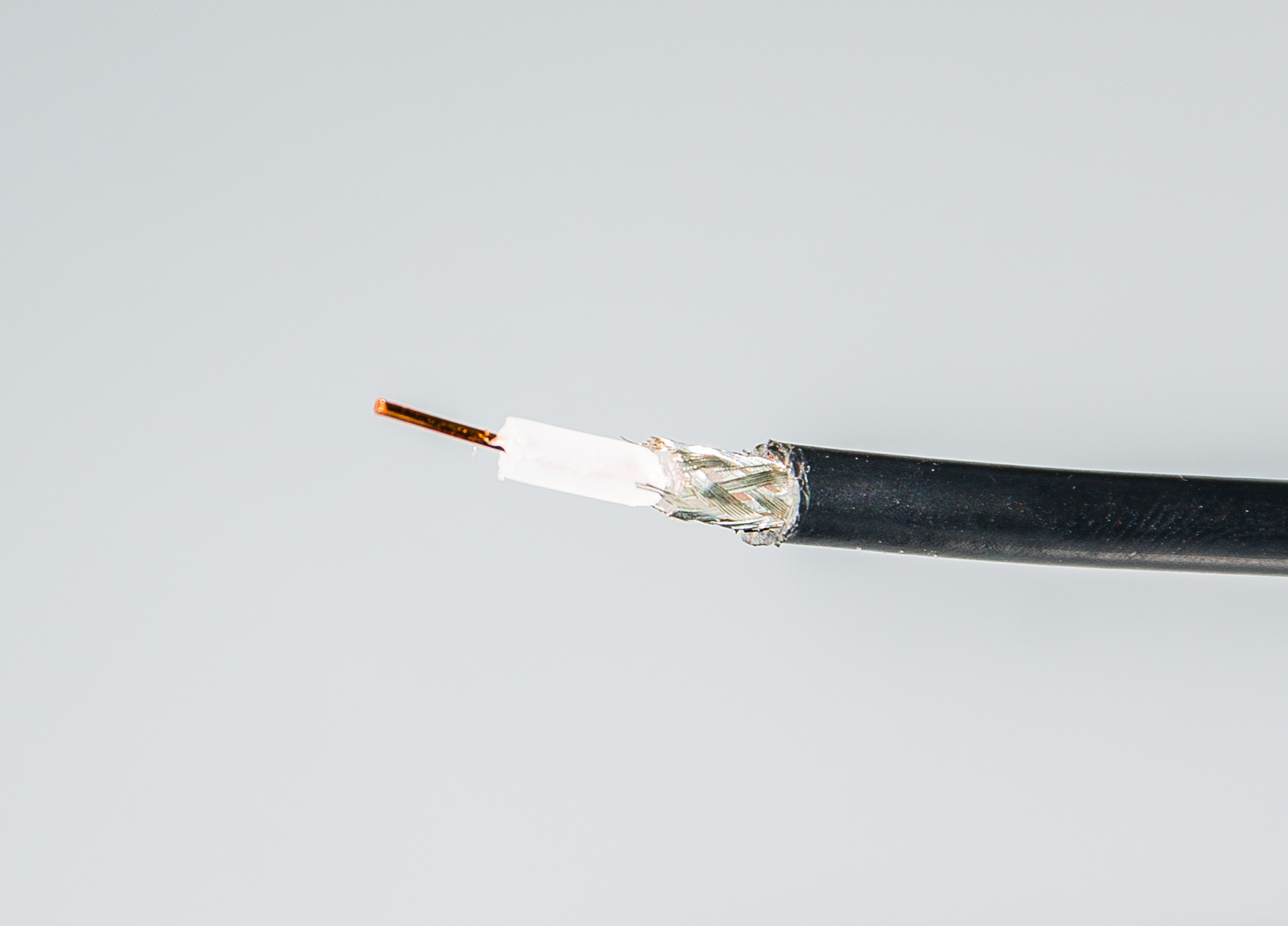
The coaxial-cable experiment conducted in the lab was with 80 m coaxial cable( RG-85). This experiment compares the TDR response between damaged and undamaged cable. For the damaged cable, the...
Search relevance: 1.00 | Views last month: 0 | Published on: 2026-01-27 -
The location and severity of infrastructural defects and damage is usually poorly understood. New technologies are needed to facilitate identification, characterization, and time-lapse monitoring...
Search relevance: 1.00 | Views last month: 0 | Published on: 2026-01-06 -
This vector shapefile is one of two layers that depict the extent of the 2003 digital orthophoto mosaic for the coastal and nearshore areas of Bering Land Bridge National Preserve (BELA), Cape...
Search relevance: 1.00 | Views last month: 0 | Published on: 2026-03-04
