
Found 29 datasets matching "4100".
-
These data and test descriptions are from a set of primarily tensile hydraulic-fracture stimulations in wells E2-TC and E2-TU and a subsequent chilled water circulation test conducted by injecting...
Search relevance: 122.29 | Views last month: 0 -
The EGS Collab project is evaluating a site for Experiment 2 (hydraulic fracturing/shearing) at a depth of 1.25 km in the Sanford Underground Research Facility (SURF) on the 4100 Level. Two early...
Search relevance: 88.90 | Views last month: 0 -
Static and dynamic elastic properties (Young's modulus, Shear Modulus, P-wave Modulus, and Poisson's Ratio) of amphibolites and rhyolites from the TV4100 and TH4100 boreholes at the Sanford...
Search relevance: 80.60 | Views last month: 0 -
This repository contains the electrical resistivity tomography (ERT) monitoring data that was collected before, during, and after shear stimulation attempts were conducted at EGS Collab. These...
Search relevance: 59.24 | Views last month: 1 -
This archived Paleoclimatology Study is available from the NOAA National Centers for Environmental Information (NCEI), under the World Data Service (WDS) for Paleoclimatology. The associated NCEI...
Search relevance: 49.75 | Views last month: 0 -
Core logs and photos from the EGS Collab project Experiment 2 for the Top Vertical well (TV4100) and the Top Horizontal well (TV 4100) on the 4100 Level of SURF (the Sanford Underground Research...
Search relevance: 48.07 | Views last month: 0 -
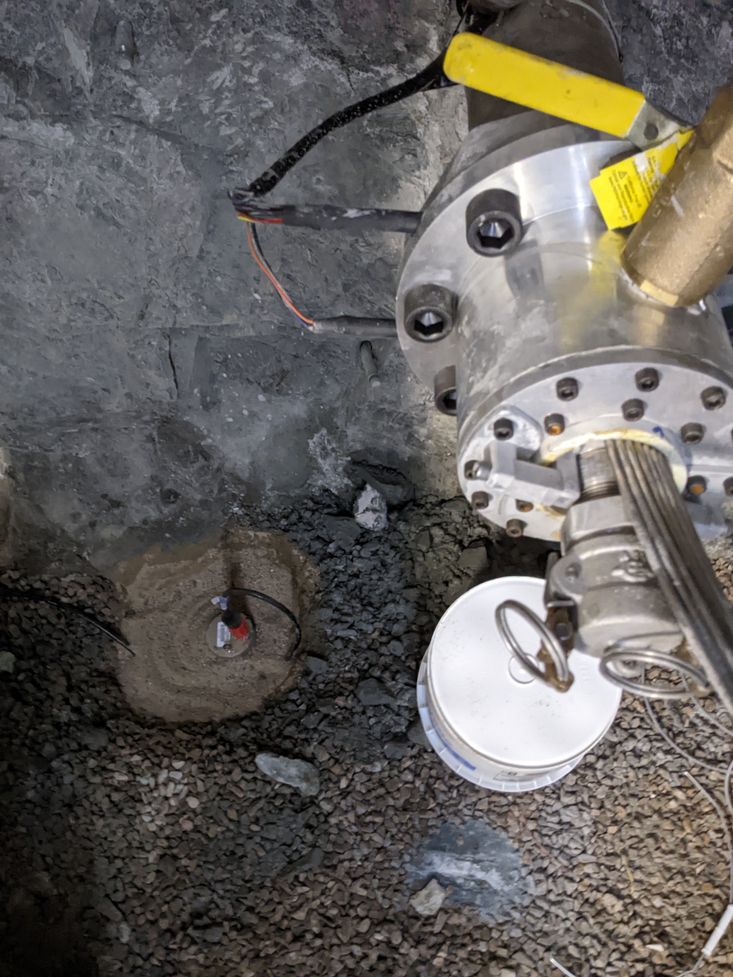
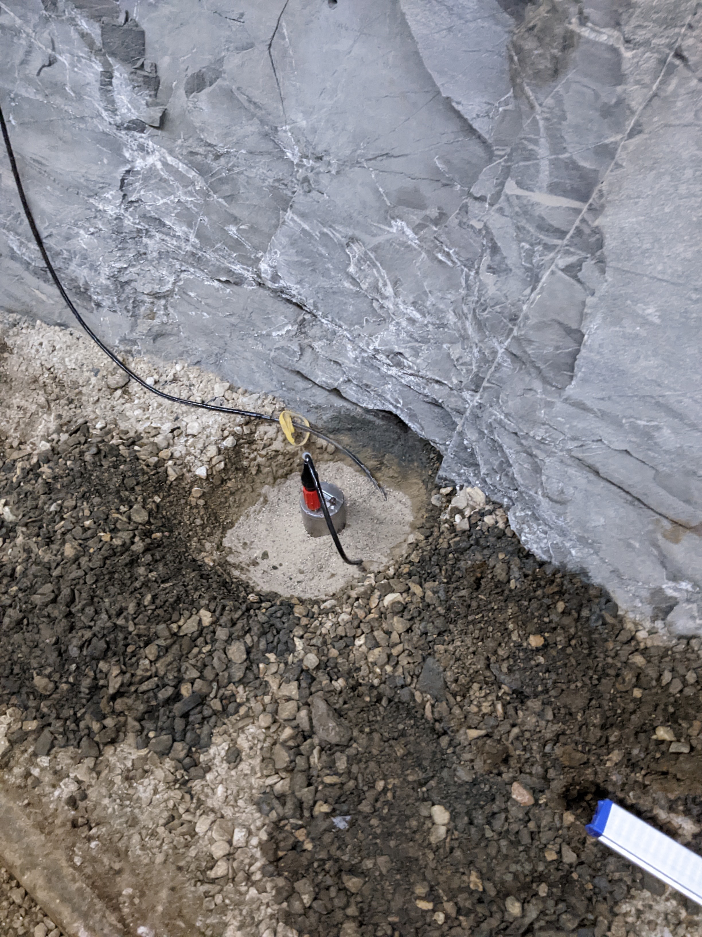
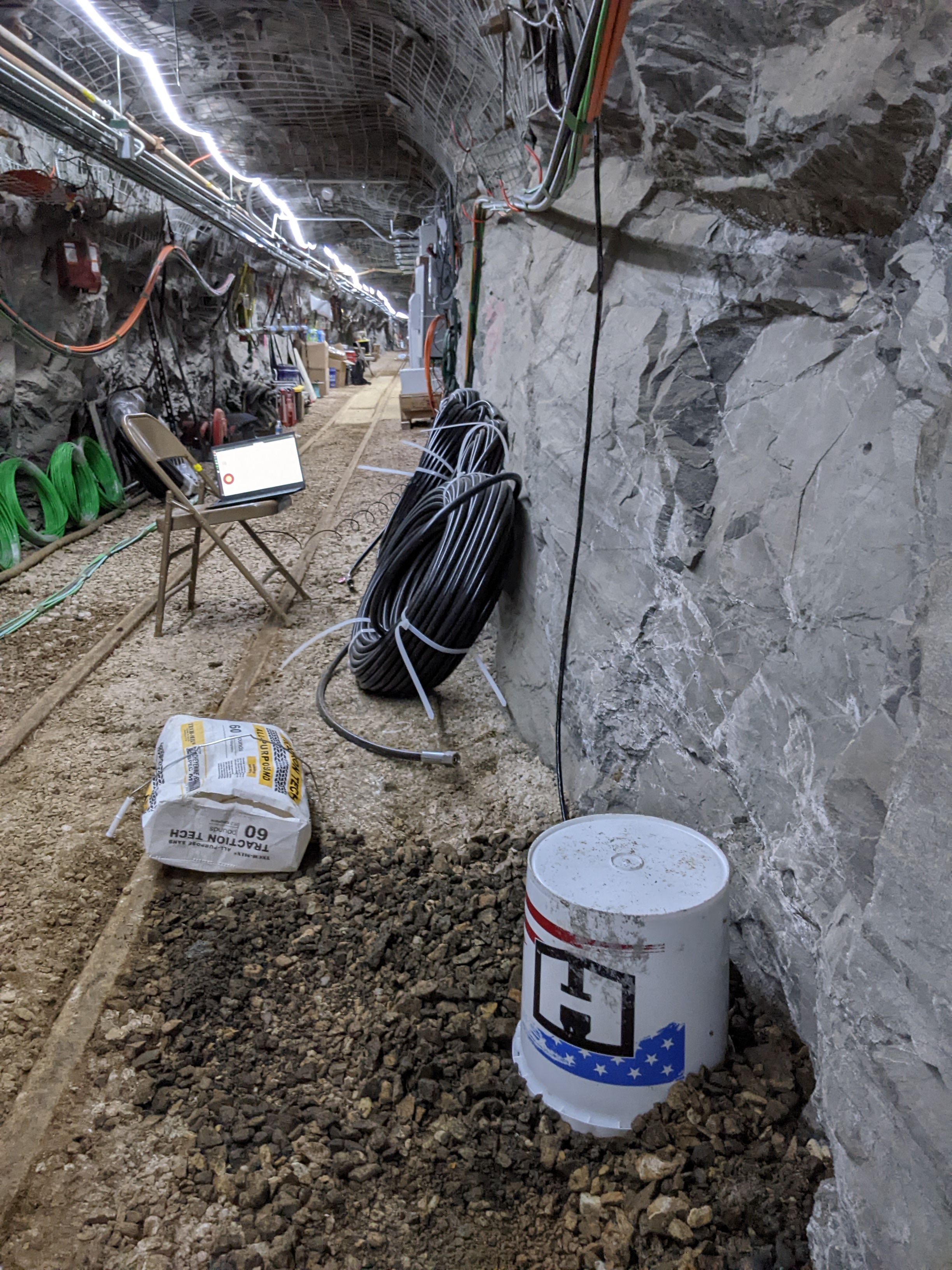
Two broadband seismometers were installed on the 4100 level and recorded for the duration of EGS Collab Experiment #2. Inspired by published data from similar instruments installed in the Aspo...
Search relevance: 47.74 | Views last month: 0 -
Gridded bathymetry (20 m cell size) of the shelf and slope environments of Johnston Atoll, Pacific Remote Island Areas, Central Pacific. Almost complete bottom coverage was achieved in depths...
Search relevance: 46.14 | Views last month: 0 -
Observations made during the 2010 CalNex measurement campaign. This dataset is associated with the following publication: Woody , M., K. Baker , P. Hayes, J. Jimenez, B. Koo, and H. Pye....
Search relevance: 39.62 | Views last month: 3 -
Gridded bathymetry (5 m cell size) of the shelf and slope environments of Johnston Atoll, Pacific Remote Island Areas, Central Pacific. Almost complete bottom coverage was achieved in depths...
Search relevance: 39.43 | Views last month: 0 -
This dataset contains the north seeking gyro data for each of the 11 boreholes drilled at the Experiment 2 testbed on the 4100 foot level of the SURF (Sanford Underground Research Facility). Each...
Search relevance: 39.28 | Views last month: 0 -
Multiple sets of tracer tests were conducted at the EGS Collab Testbed 2 on the 4100 L at the Sanford Underground Research Facility (SURF), Lead, SD. The enclosed data package includes: tracer...
Search relevance: 38.60 | Views last month: 0 -
A 20-m resolution gridded digital elevation model (DEM) grayscale hillshade compiled from ship-borne multibeam sonar surveys for the bathymetry (ocean depth) surrounding Johnston Atoll in the...
Search relevance: 36.50 | Views last month: 0 -
CMAQ and CMAQ-VBS model output. This dataset is not publicly accessible because: Files too large. It can be accessed through the following means: via EPA's NCC tape archive system (ASM) or by...
Search relevance: 35.81 | Views last month: 3 -
A 20-m resolution gridded digital elevation model (DEM) compiled from ship-borne multibeam sonar surveys for the bathymetry (ocean depth) surrounding Johnston Atoll in the Central Pacific Ocean, a...
Search relevance: 34.32 | Views last month: 1 -
The EGS Collab project is evaluating a site for Experiment 2 (hydraulic fracturing/shearing) at a depth of 1.25 km in the Sanford Underground Research Facility (SURF) on the 4100 Level. Two early...
Search relevance: 33.68 | Views last month: 0 -
The EGS Collab Project performed a series of tests to increase the understanding the response of crystalline rock mass to stimulations and fluid circulation to efficiently implement enhanced...
Search relevance: 31.50 | Views last month: 0 -
This submission contains photographs of rock core collected from EGS Collab Experiment 2 (and 3) boreholes. Cores were generally photographed in about 1-foot sections using Nikon D3300 DSLR...
Search relevance: 27.52 | Views last month: 0 -
During June 15-23 and July 10-12, 2014, the U.S. Geological Survey (USGS) conducted a nearshore geologic assessment, including bathymetric mapping, along Fire Island, New York (NY). This work was...
Search relevance: 27.05 | Views last month: 0 -
This package includes data from two days of testing at the Sanford Underground Research Facility (SURF) on the 4100 level. The tests were performed in borehole TV4100 in the battery charging...
Search relevance: 26.44 | Views last month: 1
