
Found 13 datasets matching "Homestake".
-
The Homestake Reservoir 7.5' quadrangle lies at the northwestern end of the Upper Arkansas Valley, and headwaters of the Arkansas River, and the Roaring Fork, Fryingpan, and Eagle Rivers of...
Search relevance: 113.59 | Views last month: 0 -
The data set contained herein were collected as part of a cooperative U.S. Geological Survey and U.S. Environmental Protection Agency (EPA) project entitled "Field Investigations to Help Support...
Search relevance: 102.01 | Views last month: 0 -
The datasets contained herein were collected as part of a cooperative U.S. Geological Survey (USGS) and U.S. Environmental Protection Agency (EPA) project entitled "Field Investigations to Help...
Search relevance: 73.92 | Views last month: 0 -
The datasets contained herein were collected as part of a cooperative U.S. Geological Survey (USGS) and U.S. Environmental Protection Agency (EPA) project entitled "Field Investigations to Help...
Search relevance: 73.92 | Views last month: 0 -
The EGS Collab is conducting experiments in hydraulic fracturing at a depth of 1.5 km in the Sanford Underground Research Facility (SURF) on the 4850 Level. A total of eight ~60m-long...
Search relevance: 61.11 | Views last month: 0 -
The EGS Collab project is evaluating a site for Experiment 2 (hydraulic fracturing/shearing) at a depth of 1.25 km in the Sanford Underground Research Facility (SURF) on the 4100 Level. Two early...
Search relevance: 59.48 | Views last month: 0 -
This data submission includes the raw time-lapse ERT (electrical resistivity tomography) monitoring data, flow system data, operator logs, E4D (https://e4d.pnnl.gov) inversion files, and metadata...
Search relevance: 41.33 | Views last month: 0 -
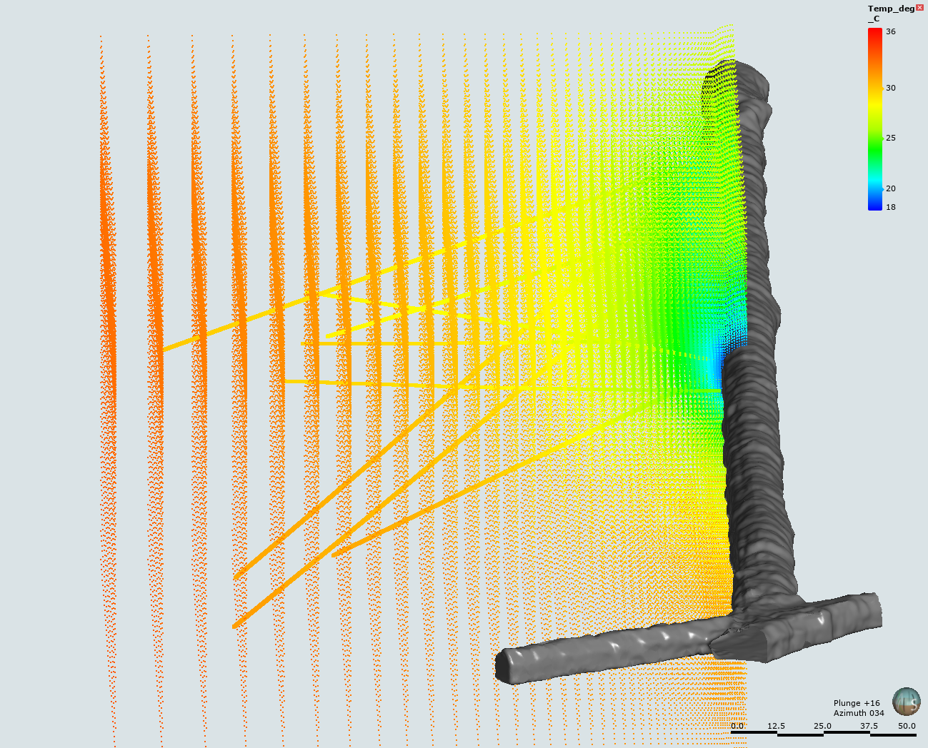
This submission includes an input file, plot file, Fortran conversion file, and 3D data file from the simulation of the temperature profile within the Test Bed #1 of the EGS Collab project. The...
Search relevance: 40.23 | Views last month: 0 -
The EGS Collab project is evaluating a site for Experiment 2 (hydraulic fracturing/shearing) at a depth of 1.25 km in the Sanford Underground Research Facility (SURF) on the 4100 Level. Two early...
Search relevance: 36.61 | Views last month: 0 -
The EGS Collab project is developing ~10-20 m-scale field sites where fracture stimulation and flow models can be validated against controlled, small-scale, in-situ experiments. The first...
Search relevance: 24.77 | Views last month: 1 -
Core logs from the EGS Collab project Experiment 1 for the stimulation (Injection) well (E1-I), the Production well (E1-P), and monitoring wells (E1-OT, E1-OB, E1-PST, E1-PSB, E1-PDT, and E1-PDB)...
Search relevance: 21.61 | Views last month: 0 -
The White Mountains airborne magnetic and radiometric geophysical survey covers parts of the Livengood, Circle, and Fairbanks quadrangles 25 kilometers north of Fairbanks, Alaska. Magnetic and...
Search relevance: 5.22 | Views last month: 0 -
This 1:50,000-scale geologic map represents a compilation of the most recent geologic studies of the upper Arkansas River valley, between Leadville and Salida, Colorado. The valley is structurally...
Search relevance: 4.97 | Views last month: 0
