
Found 12 datasets matching "USU".
-
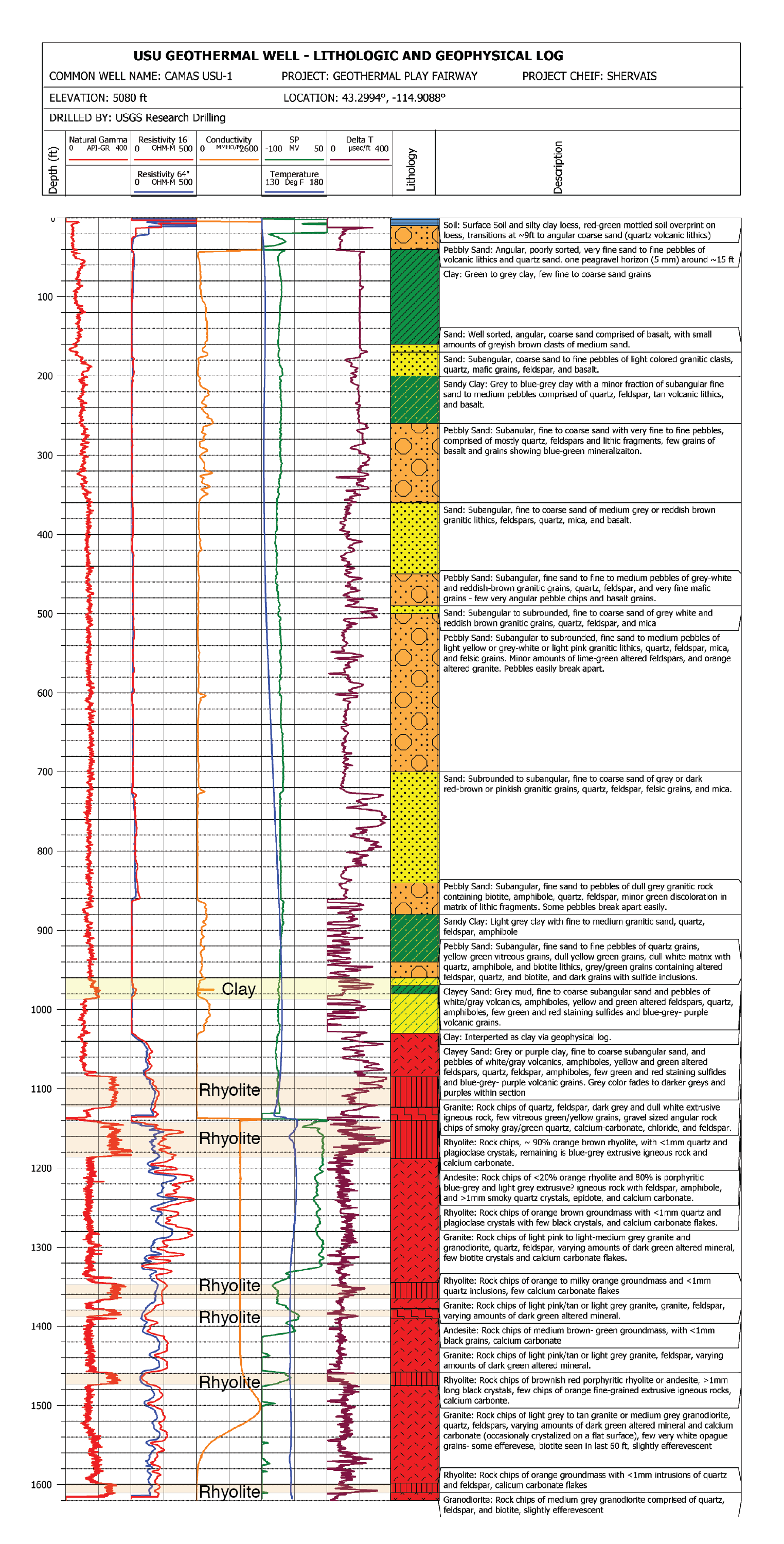
This submission contains documents that describe the USU Camas-1 test well, drilled in Camas Prairie, Idaho, in Fall 2018 and Fall 2019. The purpose of this well is to validate exploration...
Search relevance: 140.89 | Views last month: 0 -
USU Camas-1 is a geothermal test well drilled in Camas Prairie, Idaho, in the Summer and Fall of 2018. The purpose of this test well was to validate Play Fairway methodologies of the Snake River...
Search relevance: 114.98 | Views last month: 0 -
This dataset is comprised of two tables with age data along the Fairweather Fault in Glacier Bay National Park. The tables are: (1) radiocarbon dates analyzed at the National Ocean Sciences...
Search relevance: 42.69 | Views last month: 0 -
<p> <span style="font-size: 12px;"><span style="font-family: times new roman,times,serif;"> The FWMI prototype development is underway at USU/SDL. To develop the FWMI, USU/SDL is leveraging...
Search relevance: 32.97 | Views last month: 1 -
This polygon feature class represents the spatial extent and boundaries for the Utah Greater Sage-Grouse (GRSG) seasonal habitats, as modeled by the Utah State University Kohl Model Version 5. The...
Search relevance: 25.72 | Views last month: 0 -
AIRSAR topographic SAR digital elevation model L_Stokes product
Search relevance: 0.05 | Views last month: 0 -
AIRSAR topographic SAR digital elevation model LTIF product
Search relevance: 0.04 | Views last month: 0 -
AIRSAR topographic SAR digital elevation model P_Stokes product
Search relevance: 0.04 | Views last month: 0 -
AIRSAR topographic SAR digital elevation model product
Search relevance: 0.04 | Views last month: 0 -
AIRSAR topographic SAR digital elevation model CTIF product
Search relevance: 0.04 | Views last month: 0 -
AIRSAR topographic SAR digital elevation model C_Stokes product
Search relevance: 0.04 | Views last month: 0 -
AIRSAR topographic SAR digital elevation model PTIF product
Search relevance: 0.04 | Views last month: 0
