
Found 148 datasets matching "continuous seismic".
-
In May 2017 and July 2018, continuous seismic profiling (CSP) surveys were collected in Goose Pond at the Callahan Mine site. The chirp frequency CSP tool was used in the deep water. A tuned...
Search relevance: 147.95 | Views last month: 0 -
In May 2017 a dual-frequency echo sounder was used in Goose Pond at the former Callahan Mine site to obtain seismic profiles in very shallow water. The method uses two fixed transducers mounted in...
Search relevance: 145.25 | Views last month: 0 -
The U.S. Department of Energy's Enhanced Geothermal System (EGS) Collab project aims to improve our understanding of hydraulic stimulations in crystalline rock for enhanced geothermal energy...
Search relevance: 130.51 | Views last month: 0 -
In September 2018, approximately 13 miles of continuous seismic profiling (CSP) surveys were collected on the Des Moines River and Beaver Creek in Des Moines, Iowa. The swept frequency (chirp) CSP...
Search relevance: 127.90 | Views last month: 0 -
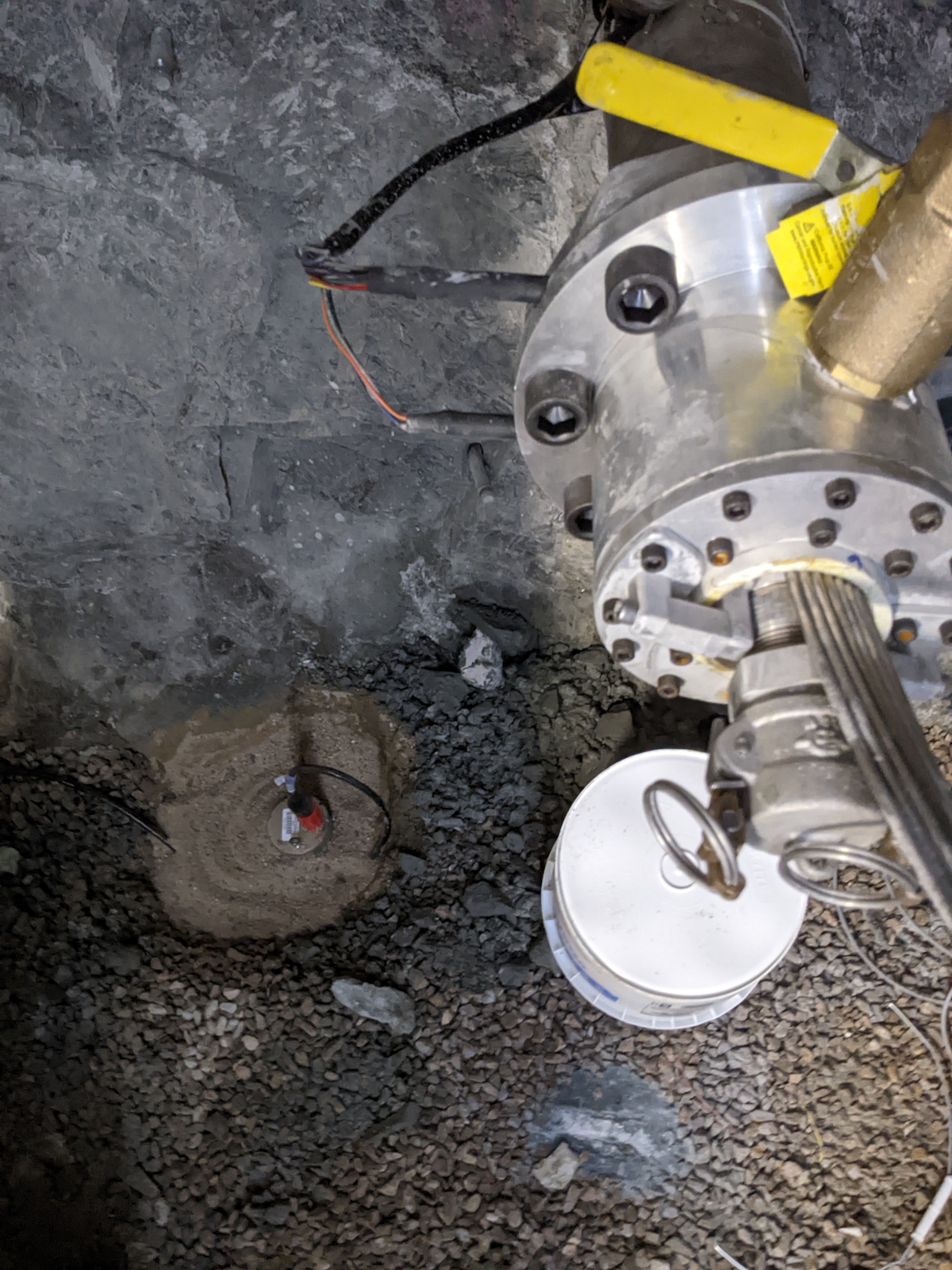
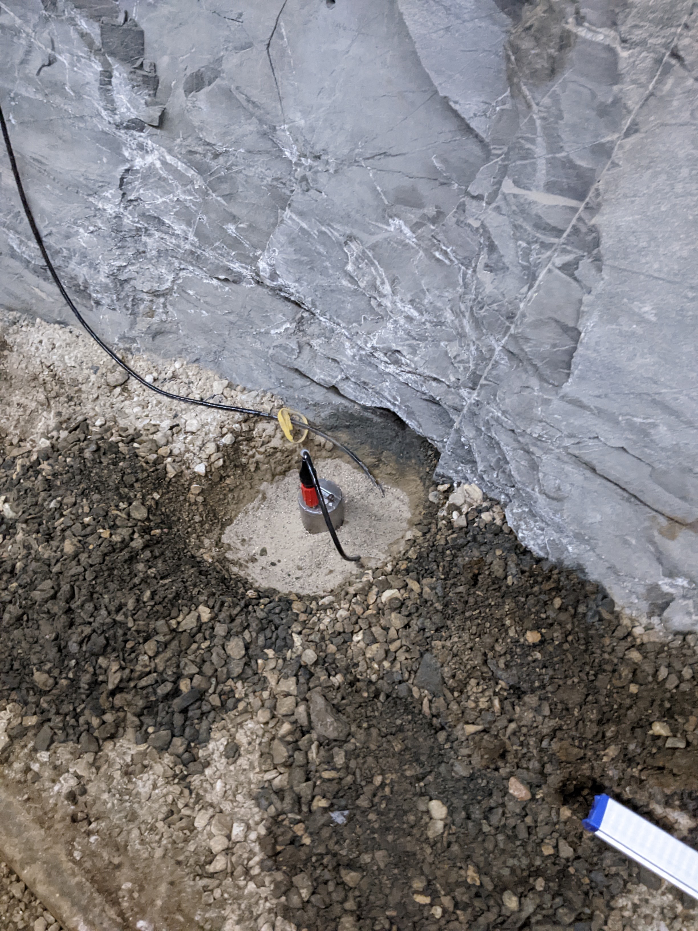
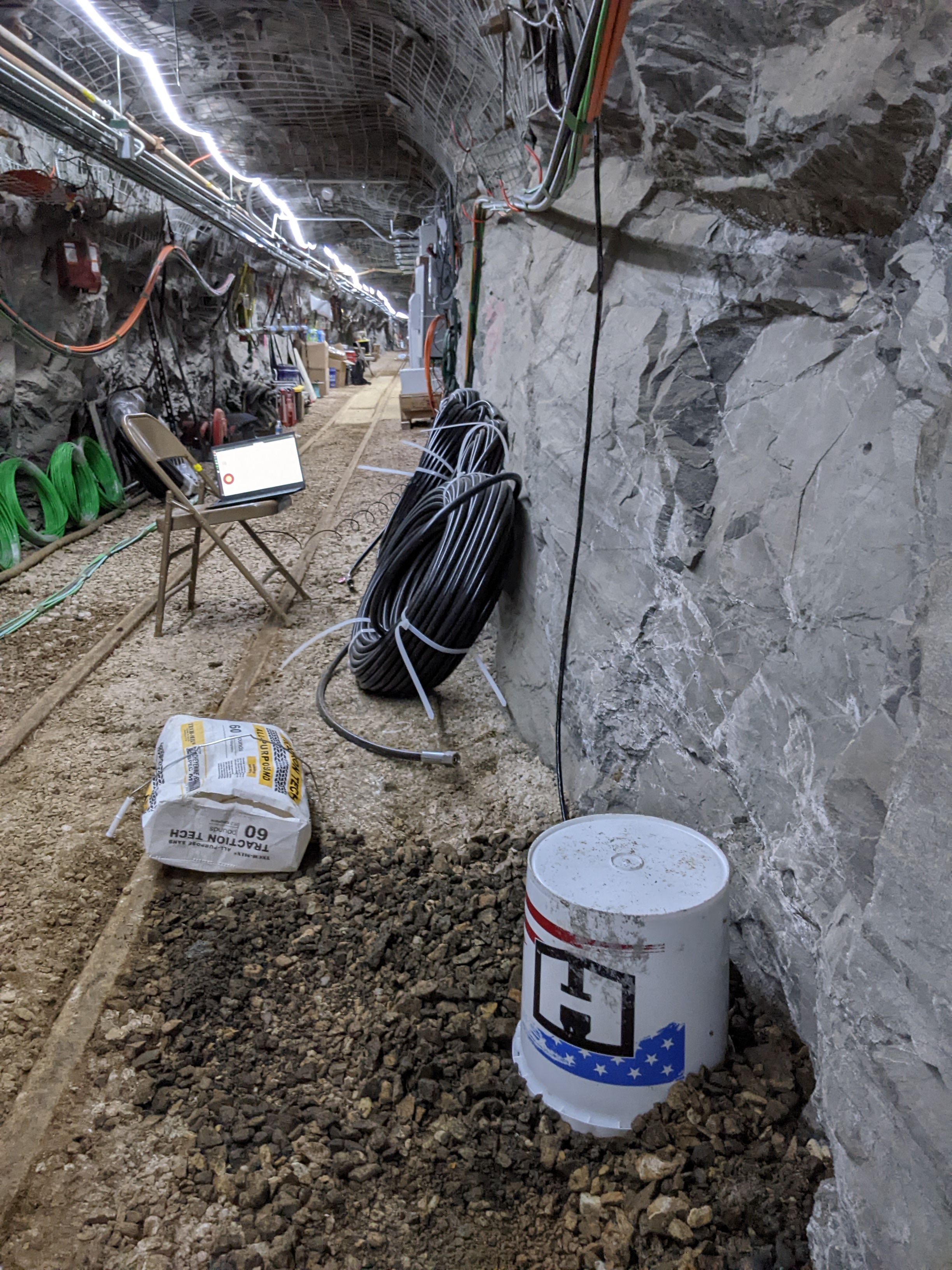
The dataset contains continuous active-source seismic monitoring (CASSM) data collected during EGS Collab Experiment 2, conducted from February to September 2022 at the Sanford Underground...
Search relevance: 123.07 | Views last month: 1 -
In April 2015, approximately 22 miles of continuous seismic profiling (CSP) surveys were collected on the Cedar River in Iowa. The swept frequency (chirp) CSP subbottom profiler was used to...
Search relevance: 108.06 | Views last month: 0 -
Two broadband seismometers were installed on the 4100 level and recorded for the duration of EGS Collab Experiment #2. Inspired by published data from similar instruments installed in the Aspo...
Search relevance: 105.31 | Views last month: 0 -
From October 2016 to July 2018, the U.S. Geological Survey, in cooperation with the U.S. Army Corps of Engineers and Maine Department of Transportation, collected surface, marine and borehole...
Search relevance: 82.45 | Views last month: 0 -
This dataset contains continuous seismic waveform data recorded during stimulation and thermal circulation tests for the Enhanced Geothermal Systems (EGS) Collab Experiment #2, conducted from...
Search relevance: 82.35 | Views last month: 10 -
A suite of geophysical methods was used along the Des Moines River, Beaver Creek, and in the Des Moines River floodplain in Des Moines, Iowa to support the hydrogeologic characterization of the...
Search relevance: 80.25 | Views last month: 0 -
This link points to the Northern California Earthquake Data Center (NCEDC) to access The Geysers seismic broadband data. The two available data sets consist of continuous waveform data recorded at...
Search relevance: 76.27 | Views last month: 0 -
In April 2015, approximately 19 miles of continuous resistivity profiling (CRP) surveys were collected on the Cedar River in Cedar Rapids, Iowa. The CRP method was used to characterize the...
Search relevance: 71.42 | Views last month: 2 -
Document describing the methodology used to determine the accelerometers' three-component orientations at the first EGS Collab testbed using Continuous Active-Source Seismic Monitoring (CASSM)...
Search relevance: 69.77 | Views last month: 0 -
This data release contains data from five seismic-reflection surveys in New York’s East River between Governors Island and the Queensboro Bridge. Data are provided in the original proprietary data...
Search relevance: 57.22 | Views last month: 0 -
The U.S. Geological Survey (USGS) Coastal and Marine Geology Program has actively collected geophysical and sedimentological data in the northern Gulf of Mexico for several decades, including...
Search relevance: 49.40 | Views last month: 0 -
The U.S. Geological Survey (USGS) Coastal and Marine Geology Program has actively collected geophysical and sedimentological data in the northern Gulf of Mexico for several decades, including...
Search relevance: 47.29 | Views last month: 0 -
Continuous seismic recordings from six Reftek seismometers deployed at Bradys Hot Springs geothermal field in Nevada from March 9th to 30th, 2016. Data is archived in mseed format. Five of the...
Search relevance: 47.11 | Views last month: 0 -
Making Earth System Data Records for Use in Research Environments (MEaSUREs) empowers the research community to participate in developing and generating data products that complement and augment...
Search relevance: 46.27 | Views last month: 0 -
These processed data were created to investigate seismic velocity changes associated with the period of extended unrest and eruption at Mauna Loa, Island of Hawaiʻi. Primary data (i.e., seismic...
Search relevance: 45.36 | Views last month: 0 -
Global positioning system (GPS) data were compiled and processed to support models for seismic hazard assessment that will be included in the 2023 USGS National Seismic Hazard Model (NSHM). This...
Search relevance: 44.87 | Views last month: 0
