
Found 28 datasets matching "electrical conductance".
-
Images of subsurface electrical conductivity are useful for locating fluids and other electrically conductive phases at depth in the Earth. This data release presents electrical conductance maps...
Search relevance: 162.38 | Views last month: 0 -
This dataset “Broad-scale assessment of biophysical features in Colorado: Soil salinity using electrical conductance” presents information extracted from the Natural Resources Conservation...
Search relevance: 150.73 | Views last month: 2 -
The “Biophysical assessment for indemnity selection of federal lands in Colorado: Soil salinity using electrical conductance” dataset includes information on soil salinity for 89 Indemnity Units,...
Search relevance: 141.49 | Views last month: 0 -
Water temperature (degrees Celsius) and specific conductance (microsiemens per centimeter at 25 degrees Celsius; TC) were measured at U.S. Geological Survey streamgage 05536995, located at Chicago...
Search relevance: 109.99 | Views last month: 0 -
The water temperature in degrees Celsius and specific conductance data in microsiemens per centimeter at 25 degrees Celsius (TC), measured at U.S. Geological Survey streamgage 05536995, located at...
Search relevance: 108.20 | Views last month: 0 -
Water temperature (degrees Celsius) and specific conductance (microsiemens per centimeter at 25 degrees Celsius; TC) were measured at U.S. Geological Survey streamgage 05536995, located at Chicago...
Search relevance: 106.40 | Views last month: 0 -
Water temperature data, in degrees Celsius, and specific conductance data, in microsiemens per centimeter at 25 degrees Celsius,(TC), were measured at U.S. Geological Survey streamgage 05536995...
Search relevance: 105.40 | Views last month: 0 -
In order to test hypotheses about groundwater flow under and into estuaries and the Atlantic Ocean, geophysical surveys, geophysical probing, submarine groundwater sampling, and sediment coring...
Search relevance: 101.85 | Views last month: 0 -
Daily average electrical conductivity (µS/cm) reported daily. Daily averages are based on hourly electrical conductance readings by the Parker Dam water quality instrument.
Search relevance: 65.46 | Views last month: 0 -
Daily average electrical conductivity (µS/cm) reported daily. Daily averages are based on hourly electrical conductance readings by the Hoover Dam water quality instrument.
Search relevance: 65.46 | Views last month: 0 -
The National Crude Oil Spill Fate and Natural Attenuation Research Site is located near Bemidji, MN, USA. A high-pressure oil pipeline ruptured in 1979 releasing ~1.7 million liters of light crude...
Search relevance: 57.15 | Views last month: 0 -
Electrical resistivity results from two regional airborne electromagnetic (AEM) surveys (Minsley et al. 2021, and Burton et al. 2021) over the Mississippi Alluvial Plain (MAP) were combined by the...
Search relevance: 50.28 | Views last month: 4 -
An irrigation monitoring experiment was performed in Haddam Meadows State Park, Connecticut, on July 16, 2019. Prior to this experiment, ground penetrating radar (GPR), frequency domain...
Search relevance: 45.73 | Views last month: 0 -
The total concentration of dissolved constituents in water is routinely quantified by measurements of salinity or total dissolved solids (TDS). However, salinity and TDS are operationally defined...
Search relevance: 45.27 | Views last month: 0 -
This data release contains geophysical and water-quality property data measured by the U.S. Geological Survey (USGS) along downstream continuous profiles in surveyed reaches of Elm Brook, Hartwell...
Search relevance: 44.73 | Views last month: 0 -
The “Biophysical assessment for indemnity selection of federal lands in Colorado: Indemnity Unit locations” dataset delineates the spatial locations of 89 Indemnity Units, comprising 339 parcels...
Search relevance: 44.50 | Views last month: 1 -
This data release contains 82.4-kilometer (km) long spatial profiles of geophysical and water-quality properties data acquired along five semi-continuous segments of the Trinity River that were...
Search relevance: 43.67 | Views last month: 1 -
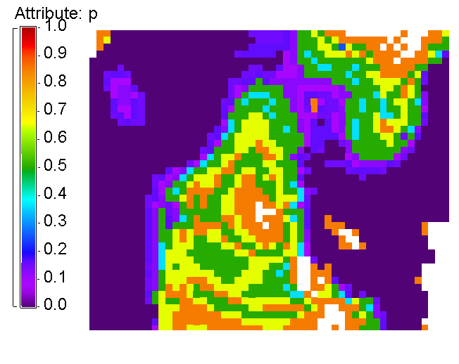
These histograms represent our calibration of conductance of a volcanic geothermal field (with a clay cap) and the observed steam flow rates. Darajat is a vapor geothermal field located in West...
Search relevance: 42.38 | Views last month: 0 -
The U.S. Geological Survey (USGS) and the National Park Service (NPS) have collaborated on monitoring the chloride flux in the major rivers of Yellowstone National Park by periodically sampling...
Search relevance: 42.13 | Views last month: 0 -
Slug additions are often the most accurate method for determining discharge when traditional current meter or acoustic measurements are unreliable because of high turbulence, rocky streambed,...
Search relevance: 41.31 | Views last month: 3
